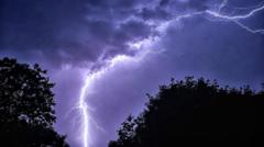
The air feels heavy, almost stagnant, carrying the unmistakable scent of ozone and scorched earth. For days, the United Kingdom has baked beneath a relentless dome of high pressure. Thermometers climbed well past historical averages, turning parks into dust bowls and straining infrastructure built for a temperate maritime climate. But seasoned meteorologists and emergency responders know the true hazard arrives not with the sunshine, but with its violent termination.
When a severe UK heatwave breaks, it rarely happens with a gentle drizzle. Instead, the sudden collision of superheated surface air and a cold front rushing in from the Atlantic triggers an explosive atmospheric reaction. The result is severe convective weather, characterized by sudden torrential downpours and flash floods. This transition poses an immediate threat to communities, turning dry urban streets into rushing rivers within minutes.
Understanding why this happens requires looking past the immediate weather forecast. The mechanism driving these sudden deluges involves fundamental thermodynamics.
The Physics of Sudden Atmospheric Collapse
Warm air holds significantly more moisture than cool air. As days of high temperatures bake the British Isles, moisture evaporates rapidly from soils, reservoirs, and vegetation, loading the lower atmosphere with invisible water vapor. When cooler air wedges underneath this buoyant, moisture-laden heat dome, the warm air shoots upward at terrifying speeds.
This rapid vertical ascent builds towering cumulonimbus clouds. Inside these anvil-headed giants, updrafts and downdrafts wage a chaotic war, condensing vast amounts of water vapor into heavy raindrops faster than the upper atmosphere can hold them.
The ground offers no immediate help. Extended dry spells bake clay-rich and loamy soils until they harden like asphalt. When heavy rain finally falls, the parched earth cannot absorb the moisture quickly enough. The infiltration rate plummets. Instead of soaking into the ground, water stays on the surface, finding the path of least resistance down hillsides, alleyways, and paved roads.
Urban Planning Meets Extreme Weather
Cities and towns bear the brunt of these rapid transformations. Modern urban centers consist largely of impermeable surfaces. Concrete, asphalt, and slate cover natural drainage basins.
Decades ago, drainage systems were designed to handle steady, moderate rainfall typical of historical British weather patterns. They were never engineered for cloudbursts that dump a month's worth of rain in less than sixty minutes. When gutters and storm drains become overwhelmed, water pools instantly in low-lying areas, underpasses, and basement flats.
Drivers frequently misjudge the depth of these sudden pools. Moving water possesses immense kinetic energy. Just twelve inches of flowing water can sweep a small car off its feet, while two inches can knock down an adult.
Emergency services face impossible choices during these events. Calls flood dispatch centers as basements flood, power grids fail due to lightning strikes, and vehicles stall in rising water. Municipal workers scramble to clear blocked drains choked with summer debris, yet their efforts often arrive too late to prevent localized property damage.
Anticipating the Flash Point
Forecasting exact locations for flash floods remains one of meteorology's toughest challenges. While large-scale weather models can predict general areas at risk days in advance, the precise trigger point of a severe thunderstorm depends on micro-scale land features and local wind convergence.
Communities must shift from reactive crisis management to proactive adaptation. Upgrading urban drainage networks requires billions in long-term investment, but simpler measures also matter. Incorporating permeable paving in residential driveways, restoring natural wetlands upstream from vulnerable towns, and maintaining local watercourses help absorb the initial shock of intense rainfall.
The transition from scorching heat to violent storms is a recurring pattern, sharpened by shifting global climate conditions. These events will test public resilience and infrastructure limits with increasing frequency.
The next time the temperature peaks and the sky turns an ominous shade of bruised purple, remember that the danger has only just begun.