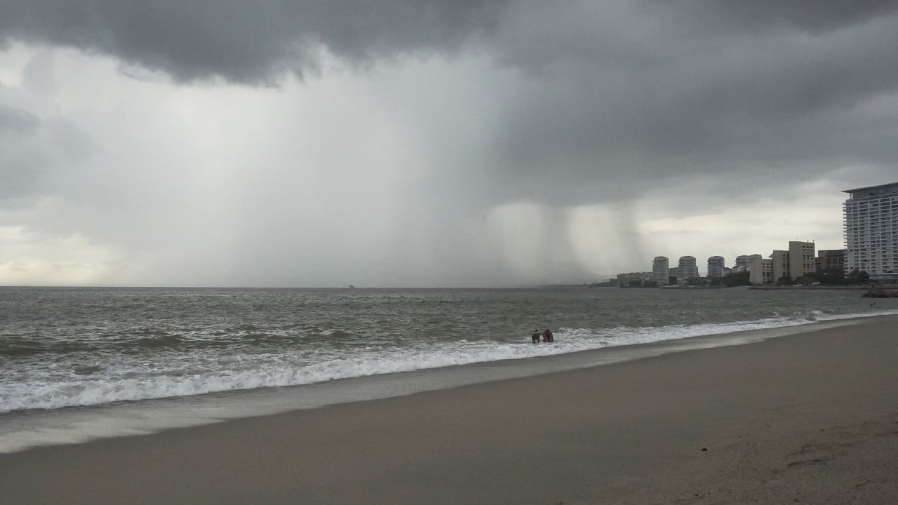
When Hurricane Trudy churned toward Mexico's Pacific coast in mid-October 2026, the headline warnings were predictable: heavy rain, strong winds, and the threat of flooding and mudslides. Yet wind speed is the wrong metric for measuring what actually destroys towns along the Sierra Madre and coastal foothills. Water is. When a slow-moving tropical cyclone dumps torrential rain onto steep volcanic slopes that have already been soaked by late-season storms, the real danger is not a peeled roof—it is a hillside giving way and turning an unpaved road or river valley into a lethal slurry.
Surface weather bulletins treat flooding and mudslides as routine side effects of a hurricane. In practice, they are the primary killer in mountainous Latin American terrain, often inflicting worse damage inland than storm surge does on the beach. A system like Hurricane Trudy exposes a long-standing fault line between meteorological forecasting and on-the-ground vulnerability: meteorologists can track cloud tops and barometric pressure with remarkable precision, while municipal drainage, hillside zoning, and rural road networks remain brittle.
Why Steep Slopes Turn Rain Into Mudslides
Watch a heavy downpour hit a flat city street and you see ponding. Watch that same rain hit a 30-degree slope in western or southwestern Mexico and you see physics in motion. Steep topography compresses watershed drainage times from hours to minutes, funneling massive volumes of runoff into narrow gullies and river channels before soil can absorb it.
Soil does not fail all at once. It saturates gradually. Early bands of rain fill the pore spaces between soil grains, increasing pore-water pressure and reducing the friction that holds earth and rock together on an incline. Once the soil reaches saturation and surface runoff accelerates, shear stress overtakes shear strength. Slopes peel away. Boulders, uprooted trees, and wet earth combine into fast-moving debris flows that travel far faster than walking speed and carry enough mass to shear concrete columns off their footings.
Weather forecasts measure wind in miles or kilometers per hour, but mountain communities measure disasters in cubic meters of saturated earth moving downhill.
In mid-October 2026, Hurricane Trudy threatened southwestern and west-central Pacific coastal areas as a potent system following closely on the heels of prior Pacific storm activity, including Hurricane Simon. Sequential storms compound the hazard. Even when a storm weakens or stalls offshore—as Trudy did at points along its track—moisture plumes and lingering convective bands can continue feeding rain into already stressed basins.
The Myth of Wind-First Storm Coverage
Coverage of hurricanes almost always leads with category ratings and peak sustained winds. Those numbers are easy to grasp and dramatic to read. They also distort risk perception. A Category 1 or Category 2 storm with a slow forward speed or a sprawling rain shield can easily generate more inland flood and mudslide devastation than a faster-moving, higher-category storm that rushes ashore and exits quickly.
Consider a hypothetical example to see how wind ratings mislead. Suppose a coastal town faces a compact Category 3 hurricane moving at 20 mph that clears the coast in eight hours, versus a slower Category 2 system that stalls near the coast for two days, feeding continuous tropical moisture into an inland valley. The Category 3 storm tests shutters and power lines. The slower storm tests river levees, culverts, and unstable hillsides—and once a hillside collapses across a mountain highway, rescue and supply lines stall for days.
Infrastructure Fault Lines Beneath the Deluge
Mexico's geography is unforgiving for civil engineering. Mountain ranges rise sharply close to the coast, leaving narrow coastal plains, winding river valleys, and thousands of dispersed communities connected by single-lane highways, bridges, and mountain tracks. When intense rain hits these corridors, failures cascade quickly.
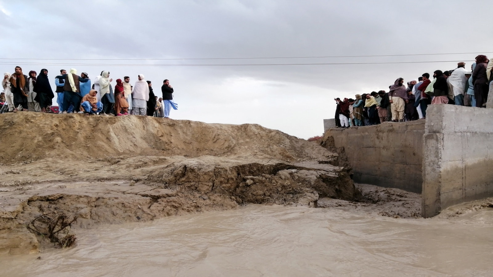
Recent severe rain and flood events across Mexico illustrate how quickly basic systems buckle under extreme precipitation. During the October 2025 floods and landslides in eastern and central states such as Veracruz and Hidalgo, intense multi-day rainfall triggered hundreds of landslides, overflowed rivers, washed out or damaged dozens of bridges and stretches of highway, knocked out power and communications for large populations, and isolated dozens or hundreds of communities. Floodwaters in low-lying river towns climbed meters high, inundating homes, clinics, and schools and leaving lingering public health risks such as mosquito-borne dengue in the aftermath.
| Hazard Mechanism | Primary Trigger | Typical Failure Point | Downstream Impact |
|---|---|---|---|
| Flash & River Flooding | High hourly rainfall rates and swollen upstream tributaries | Undersized storm drains, silted channels, low-lying riverbanks | Inundated neighborhoods, damaged homes and clinics, contamination |
| Landslides & Mudslides | Prolonged soil saturation on steep or deforested slopes | Over-steepened cuts, unstable regolith, clogged culverts | Buried roads, collapsed structures, severed community access |
| Lifeline Disruption | Debris impact, scouring around bridge piers, downed lines | Single-route mountain highways, aging substations, cell towers | Multi-day isolation, delayed emergency aid, supply shortages |
The pattern repeats across regions because the underlying vulnerabilities are structural rather than accidental. Rapid hillside settlement often pushes housing onto slopes with poor drainage and weak soil anchoring. Deforestation and agricultural clearing along steep grades strip away deep root networks that help bind topsoil. Meanwhile, clearing mud and debris from mountain roads after a storm is expensive and dangerous, yet leaving roads blocked traps rural clinics and agricultural producers alike.
Why Warnings Alone Do Not Prevent Losses
Meteorological agencies have gotten much better at spotting heavy-rain threats days ahead. Issuing a flood or mudslide alert, however, is only half the battle. People living in floodplains or along steep ravines face hard practical trade-offs when told to evacuate: leaving means abandoning property, livestock, and livelihoods to potential looting or weather damage, often without guaranteed shelter conditions or a clear timeline for returning home.
There is also a gray area in localized forecasting. Broad regional alerts for "heavy rain, flooding, and mudslides" are scientifically honest—nobody can predict the exact square meter where a hillside will give way—but broad warnings can breed alert fatigue if a specific neighborhood stays dry during one storm and gets hit hard during the next. Closing that gap requires pairing regional weather models with local terrain mapping, community-level drainage maintenance, and pre-positioned relief stocks before the rain starts.
What Comes After the Rain Stops
When a hurricane like Trudy moves away or dissipates offshore, news cycles tend to pivot quickly to the next system or the next headline. For residents in flooded valleys and landslide-prone hills, the hardest stretch often begins right as the skies clear. Standing water lingers in low spots, damaged roads complicate deliveries of clean water and medical supplies, and saturated ground remains prone to secondary slips even after rainfall tapers off.
Real resilience in hurricane-exposed mountain regions does not come from waiting for calmer weather patterns. It comes from treating hillside stability, watershed drainage, and all-weather road access as core economic infrastructure—and acting on those weak spots long before the next storm forms in the Pacific.
Hurricane Trudy lashes Mexico's Pacific coast
This video adds visual context to how Hurricane Trudy's heavy rain, strong winds, and rough coastal conditions affected Mexico's Pacific coast.