The air inside the apartment did not circulate. It simply sat there, heavy and thick, pressing down on Walter’s chest like a warm, damp sponge.
At seventy-eight, Walter knew his limits. He lived on the third floor of an old brick building in Worms, Germany, where the walls stored the mid-July sun and slowly radiated it back into his living room long after midnight. On this afternoon, the thermometer on his wooden sideboard read 36°C (97°F). Outside, the asphalt was hot enough to soften. Also making news in related news: Why France Is Winning the Race to Quietly Build Europe’s Most Invasive Surveillance State.
Walter was thirsty, but his body’s internal alarm system—the basic human mechanism of thirst—had quieted years ago, a common side effect of aging. He knew he needed groceries. More importantly, he needed to get out of the suffocating air of his apartment before his head began to throb.
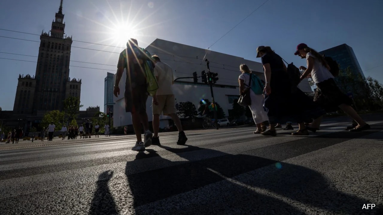
He opened the heavy building door and stepped onto the pavement. The heat hit him like a physical blow. The street before him, Wilhelm-Leuschner-Straße, was a wide, unshaded corridor of concrete, baking under the glare of a high summer sun. Walking to the market, a mere six blocks away, felt like planning an expedition across an open desert. Further details on this are explored by The Next Web.
For vulnerable people like Walter, this is not an inconvenience. It is a biological crisis.
The Silent Killer of the Concrete Jungle
We tend to associate natural disasters with spectacle. We look for the fury of a hurricane twisting through a coastal town, or the sudden, dramatic rupture of a riverbank. Heatwaves do not behave this way. They are quiet, invisible, and devastatingly lethal.
In Europe, which is warming twice as fast as the global average, urban centers have transformed into what scientists call "Urban Heat Islands." The cause is straightforward, physical math. Concrete, asphalt, and stone absorb solar radiation during the day and release it at night, preventing cities from cooling down. Between 2021 and 2024, Germany lost roughly 50 hectares of natural, heat-absorbing land every single day to transportation and commercial development. That is equivalent to 70 soccer fields of green space disappearing into asphalt every twenty-four hours.
For a young, healthy adult, a walk down a sun-drenched street is sweaty and uncomfortable. For a senior citizen, a person with a cardiovascular condition, or a parent pushing a toddler in a stroller, it is a high-stakes gauntlet.
When the human body overheats, it pumps blood to the skin to release warmth. This strains the heart and lowers blood pressure. If you are seventy-eight, your heart cannot easily double its output to keep you cool. If you are two years old, your body cannot sweat efficiently. The journey to the pharmacy becomes a calculated risk. Where is the shade? Where are the trees?
But what if the shade could be mapped?
Mapping the Shadow
In 2024, researchers at Heidelberg University’s GIScience department and the Heidelberg Institute for Geoinformation Technology (HeiGIT) looked at this problem through a different lens. They realized that while traditional navigation tools are optimized to find the fastest route, they are entirely blind to temperature, tree canopy, and solar angles.
To bridge this gap, they built the HEAL project—Heat Adaptation for Vulnerable Populations. The result was a web-based application designed to navigate users through cities not by speed, but by shade.
The technology behind this is highly sophisticated, yet intuitively simple in its execution. The app—accessible at shaded.ors—combines high-resolution 3D building models, tree canopy data, and real-time meteorological information. By calculating the precise angle of the sun at any given minute of the day, the algorithm models exactly where shadows will fall on the pavement.
Consider how a route changes throughout the day:
| Time of Day | Standard Route | Shaded.ors Route | Key Difference |
|---|---|---|---|
| 10:00 AM | Direct main street walk | Uses narrow side-alleys | Utilizes early morning building shadows |
| 2:00 PM | Direct main street walk | Diverts through city parks and tree-lined avenues | Leverages mature tree canopy to block overhead sun |
| 5:00 PM | Direct main street walk | Moves to the opposite side of the street | Adapts to the long, late-afternoon building shadows |
For Walter’s walk from the Worms main station to the Rhine, a standard GPS navigation tool would send him straight down the widest, hottest road. The HEAL app, however, recalculates his path. In the morning, it guides him down Wilhelm-Leuschner-Straße, but by afternoon, it reroutes him through the cooler, leafy canopy of Goethestraße. It is a dynamic, living map that adapts as the Earth rotates.
The Human Experience Behind the Data
Building a tool like this requires more than just sitting in a university lab writing code. The researchers knew that algorithms do not walk. People do.
To make the app truly useful, the HEAL team conducted "heat workshops" and interactive city walks. They walked the streets of Heidelberg and Worms alongside senior citizens, pregnant women, and people with mobility limitations.
They quickly discovered that vulnerability is about more than just temperature. It is about physical friction.
A route might be perfectly shaded, but if it features a steep incline, a pedestrian’s heart rate will spike, exacerbating heat stress. If a shaded path lacks benches, an elderly walker cannot rest to lower their core temperature. If a traffic light has a painfully long waiting period with no shelter overhead, the pedestrian is forced to bake on the curb.
By listening to these lived experiences, the developers refined their routing engine. The app does not just show the shady path; it provides detailed information about the path's surface, gradients, and resting spots. It transforms navigation from a cold geometric exercise into an act of collective care.
A Tool for Silent Resistance
There is a secondary, quieter power to this technology.
For years, local governments have struggled to pinpoint exactly where their climate adaptation budgets should be spent. City councils are often disconnected from the daily reality of those living in heat-prone neighborhoods.
The HEAL routing tool serves as an unintentional, highly accurate diagnostic map. When the algorithm tries to calculate a shaded route between two points in a low-income neighborhood and repeatedly finds zero options, it generates undeniable, visual proof of a systemic failure.
It shows exactly where concrete has conquered nature. It points directly to the street corners where trees must be planted, where shade sails must be erected, and where public water fountains must be installed.
It turns data into a tool for civic accountability.
The Path Forward
Walter did not know the mathematics of solar angles, nor did he understand how open-source routing APIs worked. What he did know was that as he walked toward the market using the blue line on his phone, the air felt different.
He was walking under a canopy of mature linden trees. The air here was noticeably cooler, sweetened by the scent of leaves rather than the smell of hot, bubbling asphalt. He paused on a wooden bench in the shade, took a long drink of water, and watched a young mother pushing a stroller along the same path.
They were sharing a pocket of cool air, carved out of a warming world by code, community, and shadows.